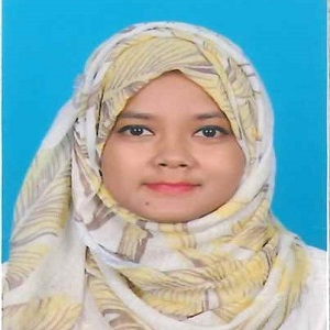
Nilufa Akhtar

Nilufa Akhtar

Assistant Professor

Department of Disaster Management & Resilience
Faculty of Arts & Social Sciences (FASS)

nilufa.akhtar@bup.edu.bd


BANGLADESH UNIVERSITY OF PROFESSIONALS
Mirpur Cantonment, Dhaka-1216

Biography

Dr Nilufa Akhtar an Assistant Professor in the Department of Disaster Management & Resilience (DMR),under the Faculty of Arts & Social Sciences (FASS) at Bangladesh Universityof Professionals (BUP). She began her academic career at BUP as a Lecturerin October 2018. She earned her PhD in Environmental Science from HokkaidoUniversity, Japan, where her research focused on spatiotemporal dynamics,coastal vegetation, mangrove, and large-scale disturbances using advanced Remote Sensing and GIS technologies. Dr Nilufa accomplished her MEng in RemoteSensing and Geographic Information System in 2019 from Beihang University,Beijing, China. Before that, she completed her Bachelor’s (BSc) and Master’s (MSc) degrees in Geography and Environment from Jahangirnagar University.

Last Updated: 03 Aug 2026

Education
S.S.C, Sher-E Bangla Nagar Govt. Girls’ High School
H.S.C, Holycross College
Masters, Jahangirnagar University
Ph.D, Hokkaido University
Bachelor of Science (BSc), Jahangirnagar University
Master of Science (Tech), Beihang University

Last Updated: 03 Aug 2026

Journal Publication

1. Akhtar, N., Israd, N., Nabila, I.A. and Bhuiyan, M.A.H., (2014). Analysis and Mapping Peripheral Changes of Sandwip Island for Erosion and Accretion. AJournal of Geography, Jahangirnagar University, Vol-33, pp.111-122,ISSN:1027-8567

2. Nabila, I.A., Israd, N., Akhtar, N. and Rashid, M.S.,(2017). Assessment of Coastal Erosion and Accretion Scenario of an Island using Mauza Maps: a GIS based study of Sandwip Island of Bangladesh. International Journal, Imperial Journal of Interdisciplinary Research (IJIR), Vol-3, Issue10,pp.438-442, ISSN: 2454-1362 

3. Akhtar, N., Nabila, I.A., Israd, N. and Rashid, M.S., (2019). Pixel-Based ChangeDetection of Sandwip Island using Remote Sensing and GIS Approaches.International Journal, Imperial Journal of Interdisciplinary Research (IJIR),Vol-5, Issue-2, pp.6-11, ISSN: 24541362. 

4. Akhtar, N., Uddin, M.K. and Tan, Y., (2021). Remote sensing-based changes in theUkhia Forest, Bangladesh. GeoJournal, https://doi.org/10.1007/s10708-021-10494-3 

5. Akhtar, N., Ibnat, A. and Khan, T.Z., (2021). Santal Communities’ AdaptationStrategies to Cope with Drought: A Study on the Selected Households ofNiamatpur Upazilla. BUP Journal, Volume-8, Issue-2. 

6. Akhtar, N., Nabila, I. A., & Rashid, M. S. Application of Historical Landsat Imageries in Detecting the Morphological Changes of Sandwip Island Using Image Analysis and GIS Approaches. BUP Journal.

7. Akhtar, N., & Tsuyuzaki, S. (2024). Effects of disturbances on thespatiotemporal patterns and dynamics of coastal wetland vegetation. EcologicalIndicators, 166, 112430. https://doi.org/10.1016/j.ecolind.2024.1

8. Akhtar, N., & Tsuyuzaki, S. (2025). The effects of disturbances derived bytropical cyclones on mangrove forests in Bangladesh. Remote Sensing Applications: Society and Environment, 101859. https://doi.org/10.1016/j.rsase.2025.101859.

Last Updated: 03 Aug 2026

Researchs

1. Remote Sensing,GIS,Forest,Coastal Ecosystem,Disturbances

Last Updated: 03 Aug 2026

Awards

1. Govt. Scholarship in SSC, HSC (Talent pool)

Last Updated: 03 Aug 2026

Courses

1.

    1    2    3    4    5    6    7    8    9    10111213141    2    3    4    5    6    7    8    9    10111213141    1    2    3    4    5    6    7    8    9    10111213141    2    3    4    5    6    7    8    9    10111213141